
National Trust Database - Search Results |
Back to search page » | |
| Displaying 1- 2 of 2 records found |
| Image | Name | Detail | File number | Level |
|---|---|---|---|---|
|
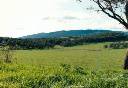
LYSTERFIELD - PROPERTY NUMBERS L10104,L10104, KNOX CITY, YARRA RANGES SHIRE |
A predominantly cleared area with a few scattered trees. The Valle is narrow and steep at its upper Eastern limits and broadens out into a flat, wide, partially enclosed plain at the North-Western end. There are outcrops of the underlying granodiorite along some of the ridge lines and the soil is generally sandy loam top-soil with a clay sub-soil.
The land is mainly used for broad scale farming activities, such as grazing, but, recently, some hobby farm
... more
|
L10104 |
Local |
|
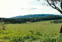
UPWEY VIC 3158 - Property No L10104 |
The Lysterfield Valley is of significance due to its attractive landscape character and its importance as a buffer between Metropolitan Melbourne and the Dandenong Ranges. LOCATION AND BOUNDARIES: Lysterfield Valley is located south-west of the Dandenong Ranges. The boundaries follow Napoleon Road, Ferny Creek, Glenfern and Kelletts Road and are contiguous with a section of the boundary of the Recorded Lysterfield Forest area. |
L10104 |
Local |
| 1 |
